
Elephant Mountain is famous for its view of the Taipei skyline, but it’s just one of the ‘Four Beasts.’ The others are Tiger Mountain, Leopard Mountain and Lion Mountain, and it’s a hike that even a couch potato can do. It’s also possible to drive to Leopard Mountain if you really want to see the view of the skyline, but have limited mobility. For avid hikers, there’s also Thumb Mountain and the 95 Peak, although I didn’t make it to either of them.
I started my hike at Tiger Mountain and ended at Elephant Mountain. I’ll share my photos and story, as well as directions on how to get there.

Tiger Mountain (Hushan/虎山)
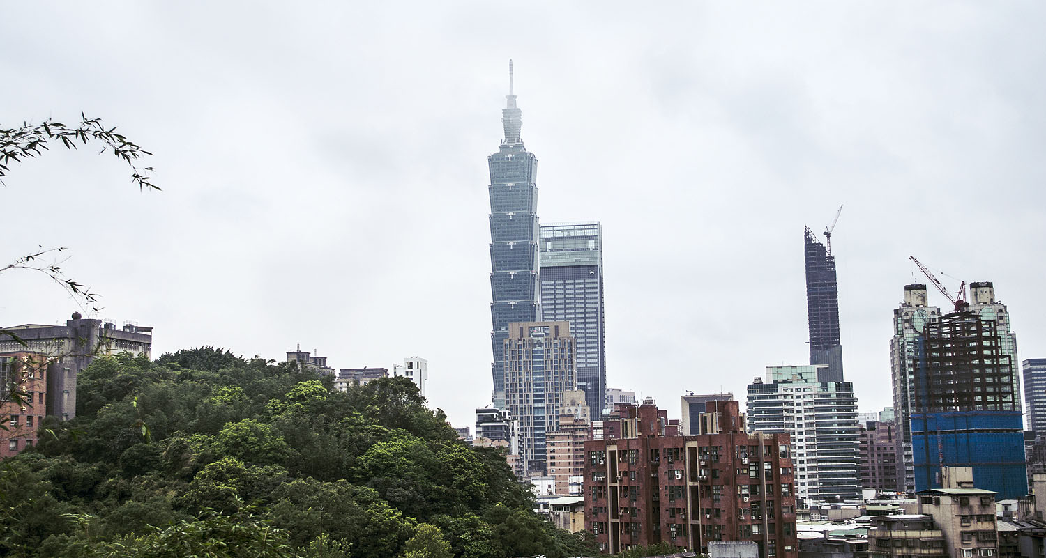
I decided to start here to avoid the especially steep climb and crowds at Elephant Mountain. I took the MRT’s Bannan Line to Yongchun and walked to the Songshan Road trail entrance, passing some nice views of Taipei 101 framed by apartment blocks.

I used to hike all the time, but I became a bit of a couch potato myself during the pandemic. I was also struggling with the aftermath of Covid that day. In the morning, I actually considered giving up and going back to my hostel after walking around Dadaocheng because I felt so bad. I was already out of breath, sweaty and dizzy when I reached the top of the first set of steps and I contemplated giving up again, but how could I when I looked back and saw the Taipei skyline? At least starting here meant there was no-one around to judge me for resting so soon. There was a toilet, small shrine and temple there.

If you can climb a few sets of stairs, but think the whole hike would be a bit much for you, you can look out at the skyline from here. It’s not the best view, but it’s nice.
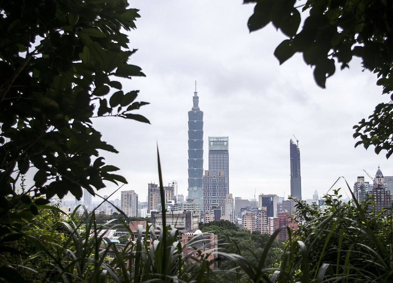
I drank some water and climbed on. When you can’t see the skyline and lush hills, the trail is surrounded by woods teeming with wildlife. I’m not going to lie… I stopped to rest twice more before I reached the peak, but as soon as I did, I was so glad I didn’t turn back. Like all the photography platforms on the trail, the Tiger Mountain one is clean, safe and, of course, offers an incredible view of the skyline in all its glory. I’d dreamed of seeing this view since I was a little kid. This peak is 142 m above sea level, by the way.

A couple arrived a while after me. I’m not sure if they thought it was cute or crazy that I was taking photos of my Zorua and Hoothoot plushies there, but they told me ‘welcome to Taiwan’ and offered me some milk sweets, which were really nice.
Leopard Mountain (Baoshan/豹山)
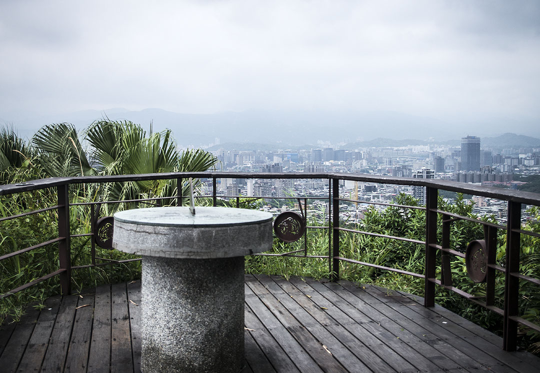
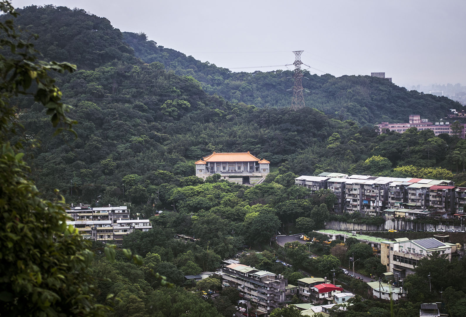
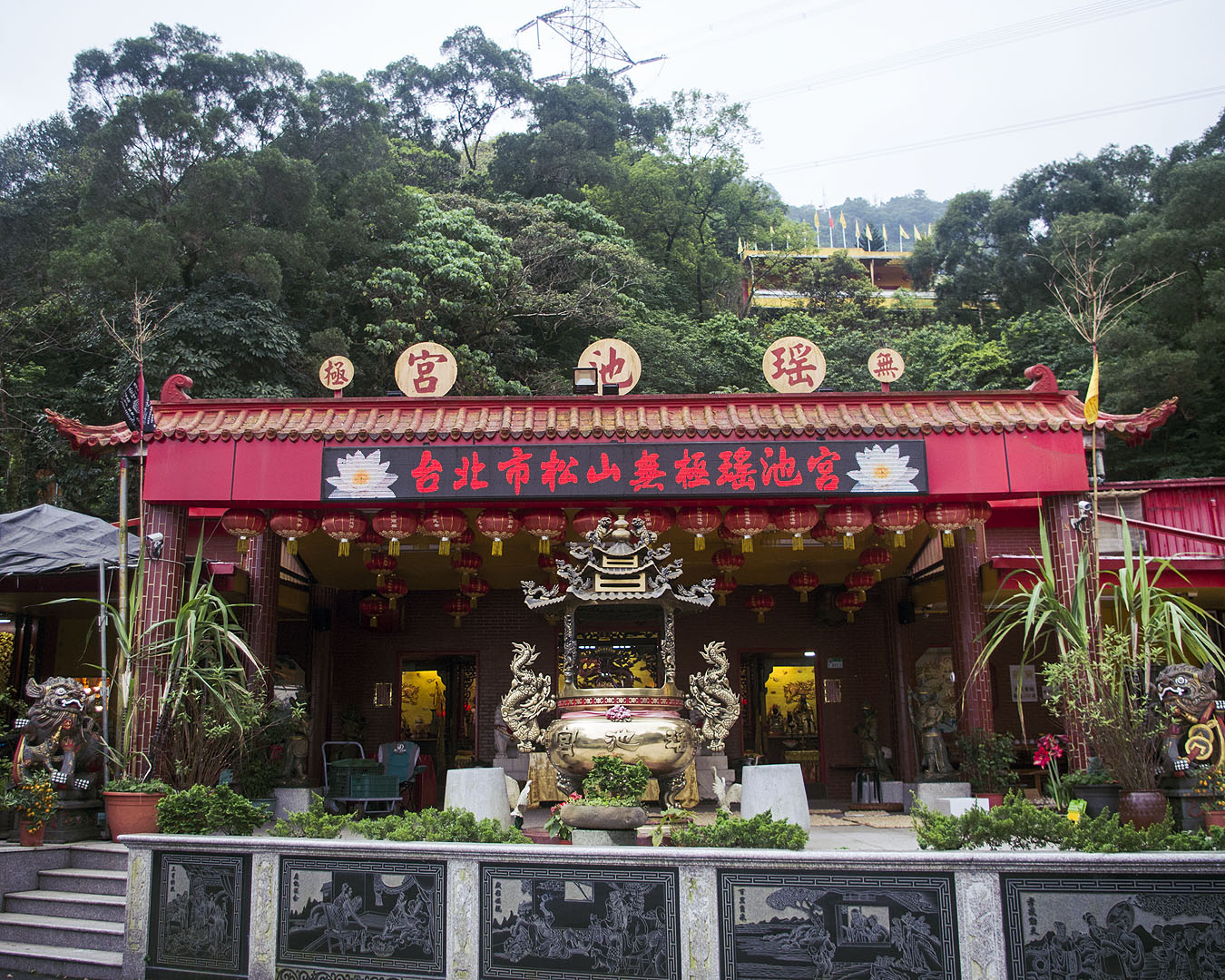
Continuing up and down a few more sets of steps and along a winding road, I eventually reached a temple I knew was close to the Leopard Mountain peak. Like Tiger Mountain, this peak is also 142 m above sea level.
There were a few more people on the trail when I left Tiger Mountain – Taiwanese pensioners were practically sprinting past me – but no-one there when I reached Lion Mountain’s photography platform. Apparently the area is haunted. If you want a good chance of having the platform to yourself, this peak is the one for you.


As I mentioned before, it’s actually possible to drive here since the short path to the viewpoint is on a regular road. If you aim for the temple (25°01’37.2″N 121°34’58.2″E), you’ll soon see the sign pointing to the path. It’s unfortunately still inaccessible to wheelchairs, since there are small steps on the way to the photography platform, but if you can climb the stairs at home you’ll definitely be able to get to the platform from the road. Bear in mind that if you take a taxi, you’ll need to ask the driver to wait, since you might struggle to get one back otherwise.
Lion Mountain (Shishan/獅山)
The dirt trails leading through the forest to the Lion Mountain peak – 152 m above sea level – are a short walk from Leopard Mountain. I actually didn’t go to the peak. There’s just a pillar at the peak itself, and although it is possible to glimpse the skyline by scrambling through the forest, it’s not as easily accessible as the other peaks and it was getting quite late. I didn’t want to miss the sunset at Elephant Mountain, so I settled for photos of the road and sign pointing to Lion Mountain. I kind of regret not visiting all of them though. I’ll just have to go back.


If you choose to go to 95 Peak and Thumb Mountain, you’ll veer off around here, but since I didn’t go, I won’t go into any detail about them.
Elephant Mountain
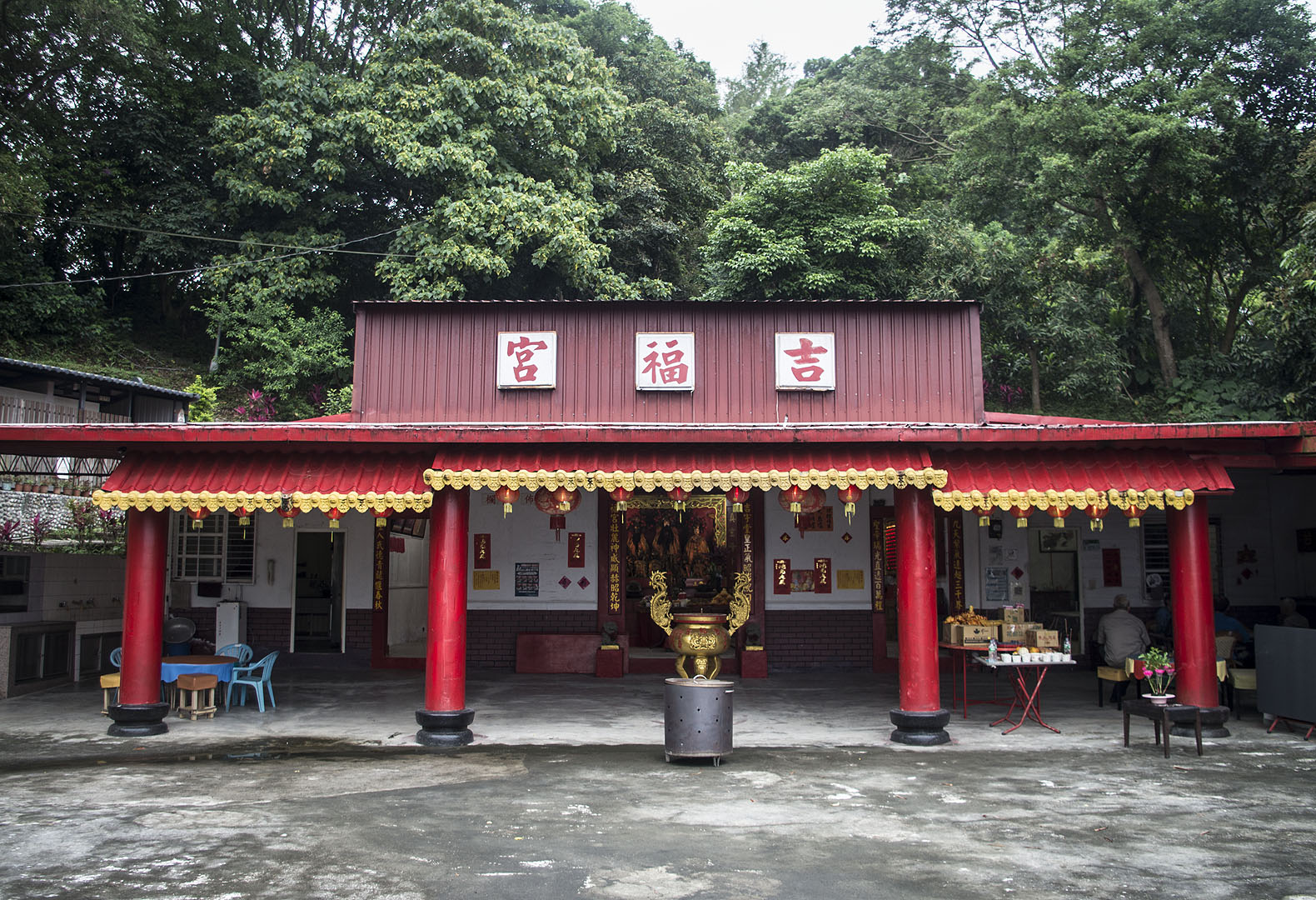
I headed straight for Elephant Mountain from the Lion Mountain sign. Because all the steps were getting a bit rough for me in the state I was in, I decided to take a longer route following Songshan Road to avoid them. Some blokes in a lorry stopped to ask where I was from and say ‘welcome to Taiwan.’ That encounter definitely wouldn’t have been so wholesome in England. At the end of Songshan Road there’s a nice temple, so the detour was worth it.

There were still some steps to climb on the final stretch, but they weren’t too bad and there was a water fountain on the way. Other than the lorry, a few cars and one dog walker, the route had been empty since I left Leopard Mountain.
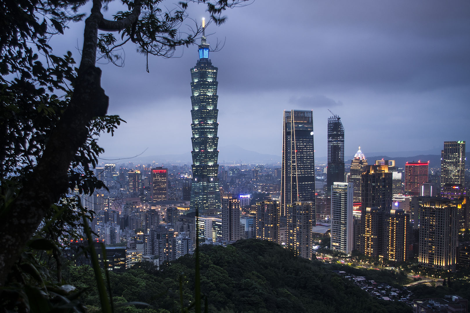
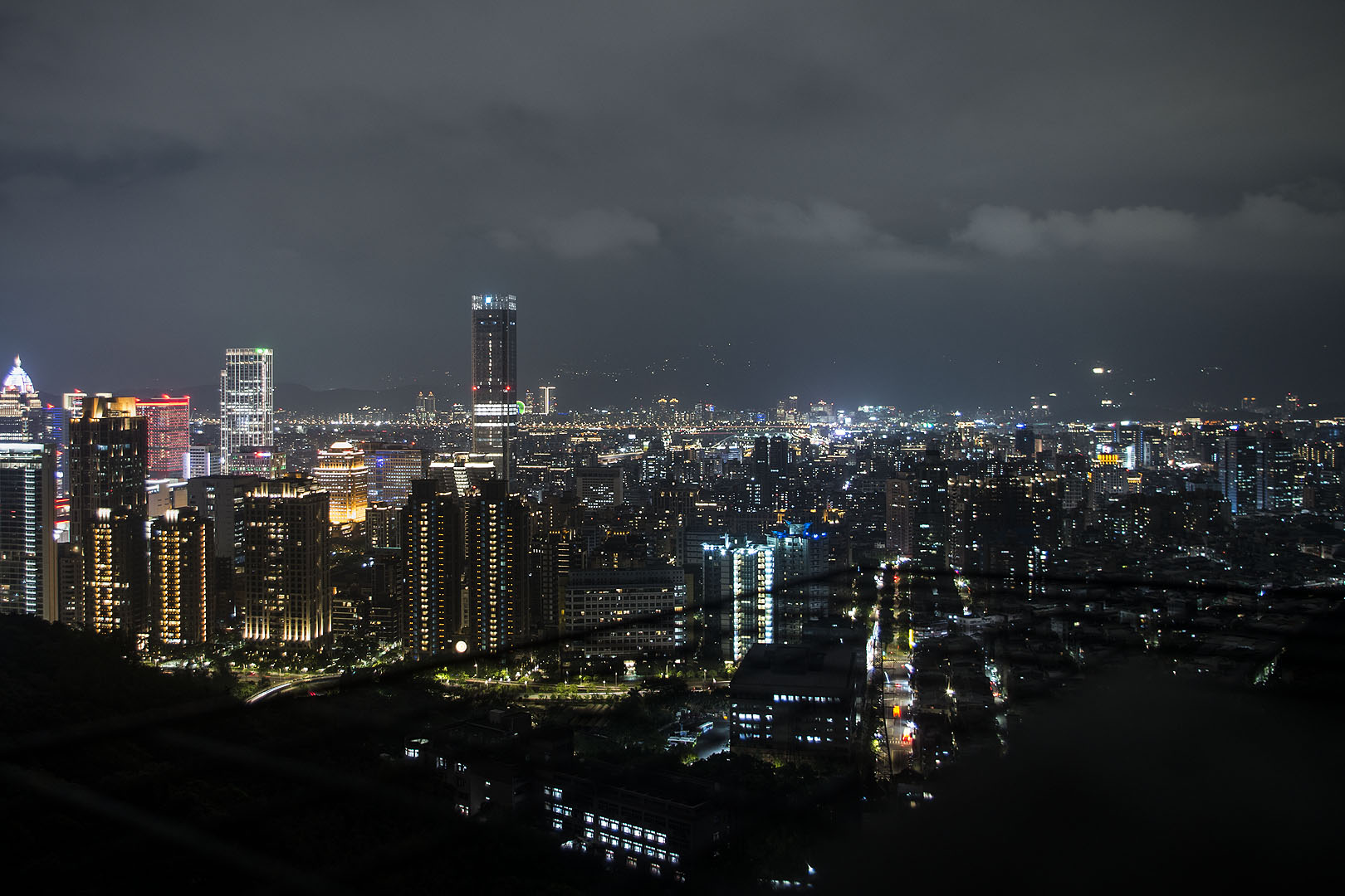
I expected crowds when I finally reached Elephant Mountain. Although there were quite a few people in the pavilion – mostly from Singapore and the US – and some fellow Europeans where the trees parted for the first glimpse of the most famous view of the skyline, there weren’t anywhere near as many people as I expected. I was able to start taking photos right away… and it was glorious! This peak is 183 m above sea level.

There was no exciting sunset, but I loved watching the city light up for the night.
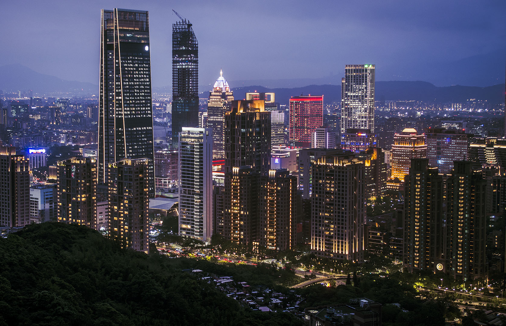
There’s also a platform with a great view a bit further down from the point I arrived at. You don’t actually need a tripod to take night shots unless it’s super windy – there are flat surfaces on the railings that are perfect for resting a camera on.

My legs actually gave up and folded as I walked up to the platform, but fortunately I don’t think anyone noticed. Even that wasn’t that busy, and the few people there were busy admiring the skyline. I’m not surprised. This is the photo I dreamed of taking. What a view!

It should have been an easy descent. There are a few trails leading down the mountain. I picked the one I thought went the right way. I could see quite a few people going the other way, and I knew once I’d climbed down several sets of stairs without seeing a single other person that I’d made a mistake… but I didn’t want to go back up the steps! I should have. Since most people don’t go that way, it wasn’t very well lit. I had to use my phone’s flashlight. The steps were slippery from the rain earlier in the day. I nearly went flying a few times and realised that if I did, no-one would know because only I was stupid enough to go that way. I couldn’t even tell anyone back home where I was because I didn’t get a SIM card. I just tried to walk slowly and eventually, after what felt like forever, I finally reached the end of the steps and walked down a steep hill that took me to Taipei City Hospital. I survived! Still, don’t go that way unless you actually need to for some reason. There’s nothing to see, the steps are poorly lit and the trailhead is further from the MRT than the others.
Despite that and how tired I was, it was a great hike and the views were worth it all. My photo from Elephant Mountain might be one shared by almost everyone who ever visits Taipei, but it’s probably my favourite photo from my trip. That was the first view I saw from Taiwan after falling in love with the map in my atlas as a little kid, and now I’ve finally taken that photo myself. If (hopefully when) I return to Taiwan, I’ll definitely do this hike again – I need to see Lion Mountain, 95 Peak and Thumb Mountain!
How hard is the hike, really?
If you’re very fit and hike all the time, it’s easy.
If you ever get out of breath climbing stairs (I know many young British people who do, so don’t feel bad), you can do it (I did, after all) but you’re going to find it strenuous. There are places to rest though. Just make sure you do stop to rest and take plenty of water. You might also want to take hydration tablets if it’s hot.
If you can only climb a few sets of stairs, you’ll be able to reach that first area with the temple on the way to Tiger Mountain. It’s not the best view of the skyline, but it is really nice and you won’t be dealing with the crowds you’ll see if you try to make it part of the way to Elephant Mountain. Keep in mind that you’ll also need to walk 950 m / 0.6 mi to the trailhead if you take the MRT though.
How to get there, starting at Tiger Mountain
I recommend starting here to avoid the even steeper climb and crowds at Elephant Mountain. There are several trailheads leading to Tiger Mountain, but these are the ones you’re most likely to use:
- Hushan Trail (虎山步道), starting on Songshan Road (25°02’10.4″N 121°34’53.3″E). This is the one I took.
- Fengtian Palace Trail (奉天宮步道) near the Songshan Fengtian Temple (25°02’10.3″N 121°35’04.3″E).
- Hushan Creek Trail (虎山溪步道) near the Songshan Cihui Temple (25°02’11.0″N 121°35’14.9″E).
The closest MRT stations are Yongchun and Houshanpi. There are also bus stops closer to the trailheads.
Once you’re on the mountain, just follow the signs. It’s almost impossible to get lost.
How to get there, starting at Elephant Mountain
The coordinates for the Xiangshan Trail (象山步道) are 25°01’38.6″N 121°34’14.8″E.
- By MRT: Take the Tamsui-Xinyi Line to Xiangshan and head past Xiangshan Park to the trailhead.
- By bus: There are bus stops on Songren Road, served by the 32, 33 and M17 buses. Check Google Maps before you go to make sure this info is up to date.
Like Tiger Mountain, once you’re up there, just follow the signs.
